From “mild to monster,” Hurricane Otis’ rapid intensification worrying experts
MIAMI – People in Acapulco, Mexico are desperate for help, as they continue to deal with the aftermath of Hurricane Otis.
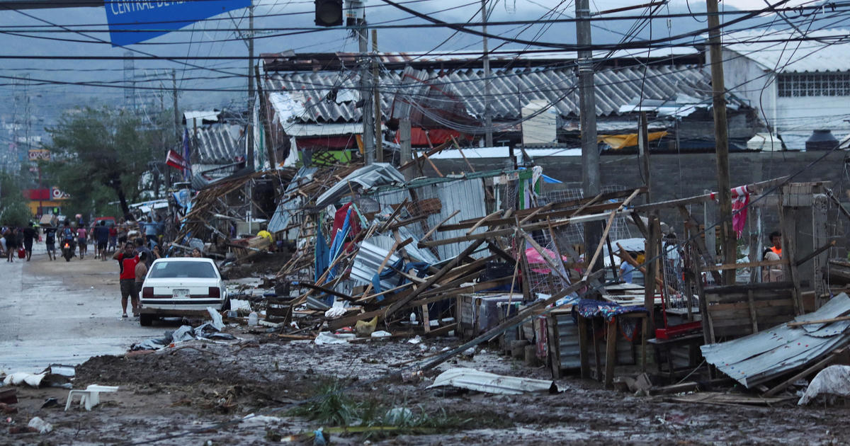
The powerful Category 5 hurricane arrived with little warning or time to prepare, killing more than two dozen people.
Otis rapidly intensified from a tropical storm to a powerful Category 5 hurricane in less than 24 hours, catching forecasters off guard.
“This is the kind of a storm that keeps me up at night during hurricane season,” said NEXT Weather chief meteorologist and hurricane specialist Ivan Cabrera.
Cabrera says Otis turned from mild to monster in record time and scientists are struggling to figure out how.
“There’s nothing left, We need them to help us,” said Teresa Fuerte, Acapulco resident.
It was a nightmare scenario for residents, as the unexpected storm struck, killing at least 27 people.
People expressed frustration 48 hours after devastating rain and sustained winds of 165 MPH crumpled buildings and flooded streets.
They say authorities haven’t accomplished much.
“I had to go and move (debris from the road) to be able to pass, and (the police) are just there chatting,” said Adelina Cruz, a local resident.
Could South Florida see the same type of rapid intensification in storms forming in the Atlantic?
Ivan says yes, but Otis was unusual.
“Rapid intensification is a process that makes sense to us if it goes over particularly really warm waters. That wasn’t the case here. That wasn’t the case here. The waters were average for this time of year,” explained Ivan.
Many experts stress the urgency of addressing climate change and reducing emissions to prevent more frequent and devastating storms in the future.
“So we’re getting more intense hurricanes as the planet warms, the ocean warms. And that is the energy that these systems feed off of. The warmer the water really the more intense the hurricane can become,” said Ivan.
Ivan says in the case of Otis, none of the models predicted the rapid growth.
While they can predict the direction of the storm, the prediction of the strength still needs work.