Hot, Steamy Sunshine Rest of Holiday Weekend – WSVN 7News | Miami News, Weather, Sports
Following a hot start to the weekend with a few evening showers, the heat will persist into this new week, especially the rest of this Memorial Day holiday weekend.
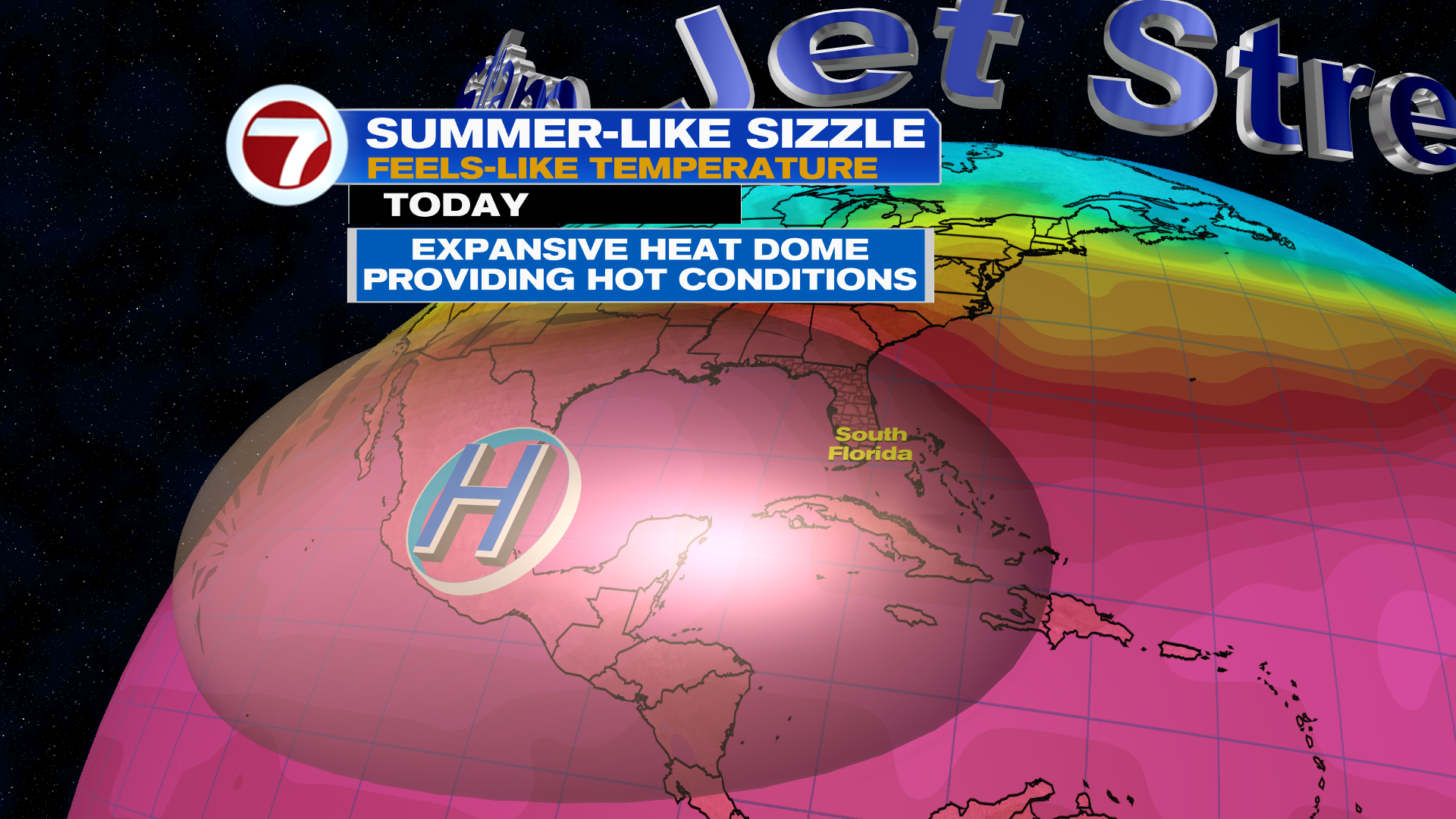
Temperatures will be a tad warmer and feels-like temperatures will be higher courtesy of an increase in humidity. Expect feels-like temperatures the next couple days to reach up to 100-105F at most areas.
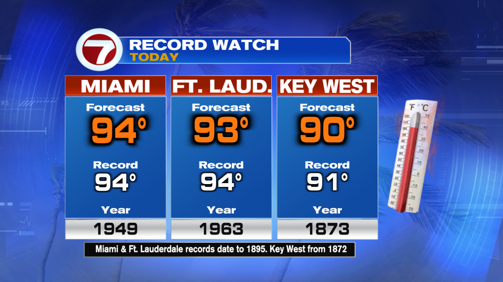
Actual temperatures will be flirting with records once again, especially this Sunday, with forecast highs in the low to mid 90s.
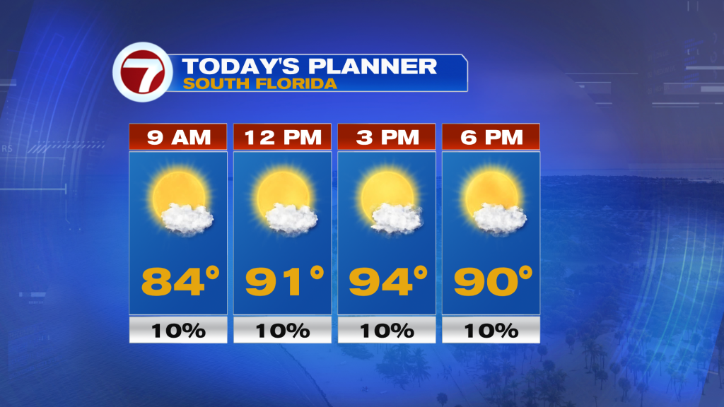
This heat will be paired with generally sunny skies and dry conditions besides a spotty shower developing along the afternoon sea breeze.
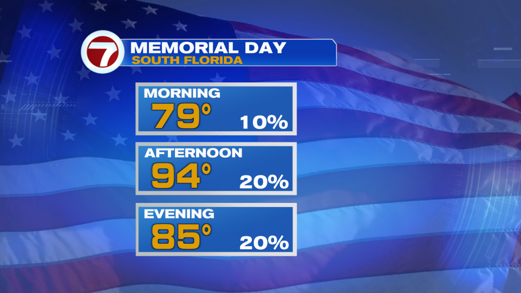
That sea breeze will have just a little bit more moisture to work with on Memorial Day tomorrow, spawning a few, spotty showers but much of the day and most areas will stay dry.
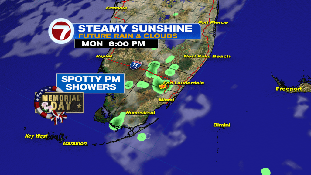
Expect sunny to partly cloudy skies with highs again in the 90s on Memorial Day.
Then as we work our way into the work week, a couple upper level disturbances are forecast to rotate across Florida, which should help instigate isolated to scattered showers and thunderstorms on a daily basis. None of the next seven days are looking like a washout or very wet days but some locations could see some rain everyday starting Tuesday.
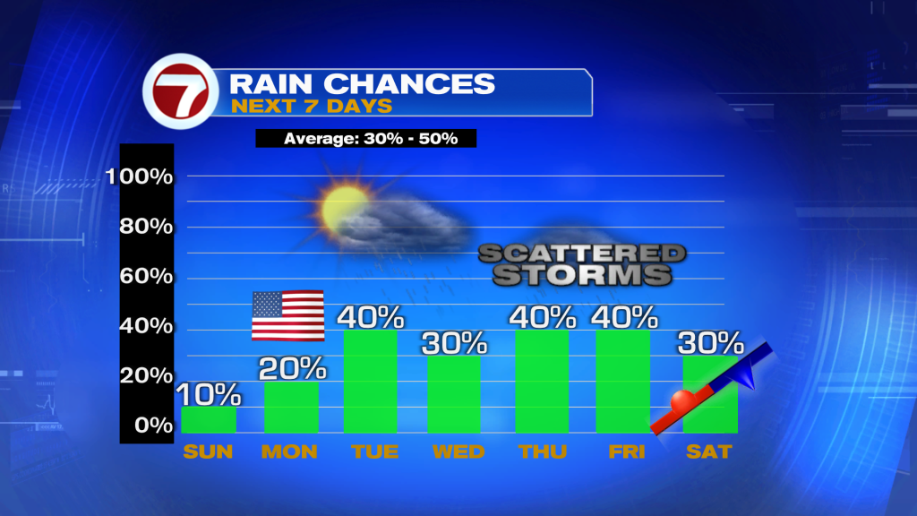
Then a weak front will make an attempt to cross through next weekend, which could drop our rain chances and temperatures somewhat.


:quality(70)/cloudfront-us-east-1.images.arcpublishing.com/cmg/F57Q3VIV4VBI7G5XXK2NDQEMBY.jpg)