Damp & Dreary Sunday As Active Pattern Continues – WSVN 7News | Miami News, Weather, Sports
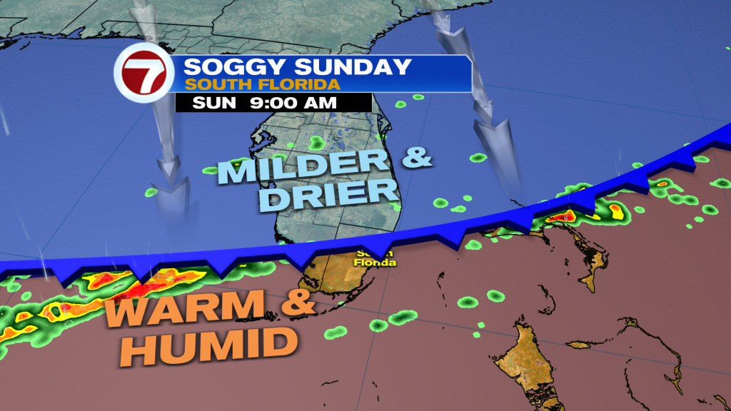
The start of our weekend sure ended on a stormy note late in the day Saturday with a likely tornado touchdown across parts of Fort Lauderdale. The National Weather Service will survey the damage to determine how strong this potential tornado was this Sunday.
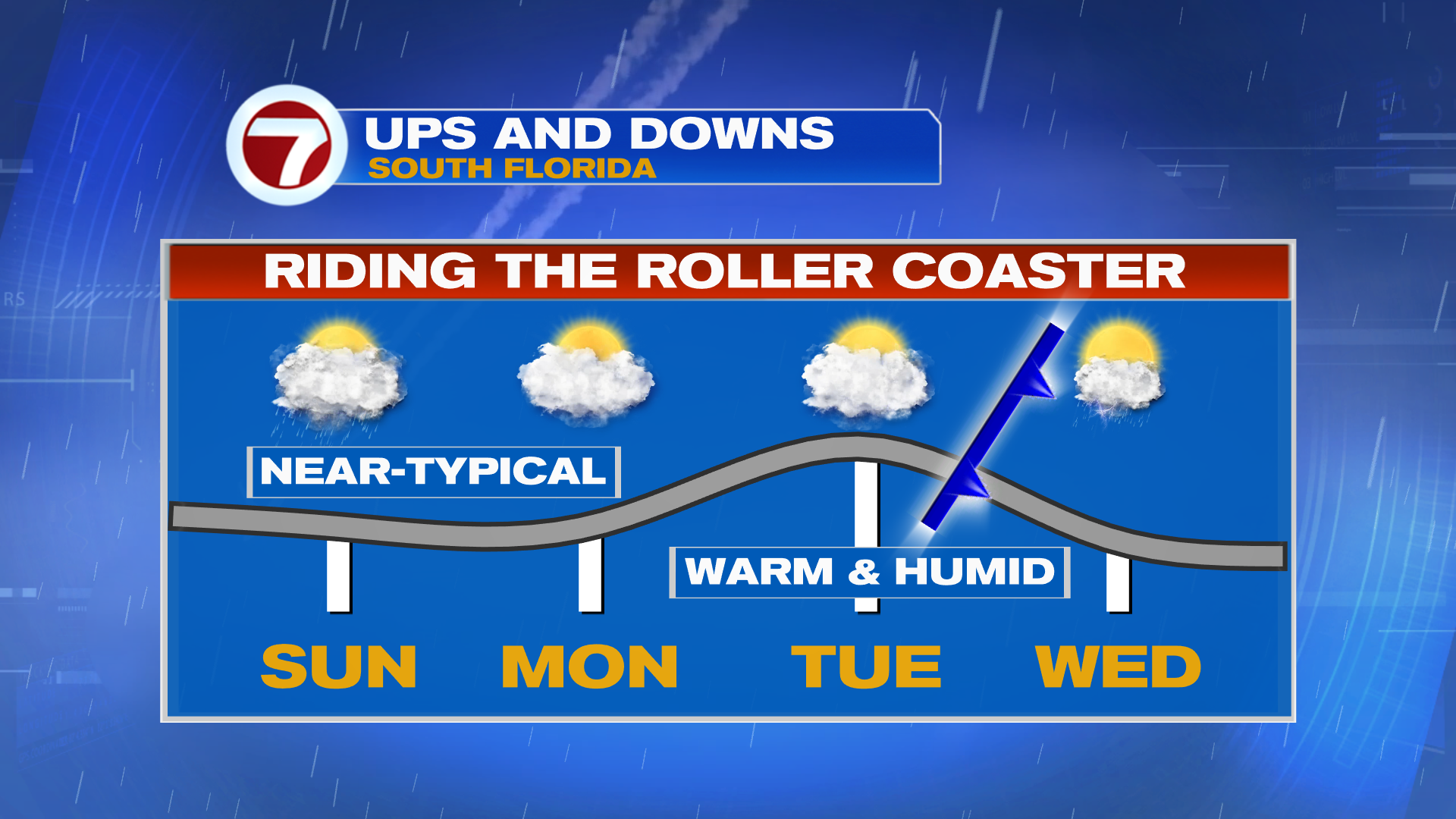
Thankfully today, severe weather is not expected. It won’t be dry, however, as we’re still waiting for the front that helped lead to yesterday’s mischief cross through midday today. Expect mostly cloudy skies through the duration of the day with passing showers, some of which could contain heavy pockets of rain and lightning. It won’t be a washout but it will be more of a damp and dreary day.
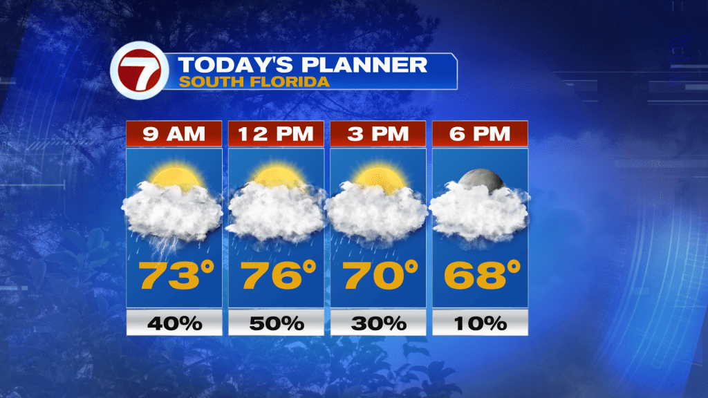
Highs will reach the mid 70s late in the morning before falling a few degrees in the afternoon as that front arrives. That front will also usher in lower humidity.
Monday will be more of a transition day with dry but mostly cloudy skies forecast. It will be breezy but mild with highs again in the mid 70s ahead of our next storm system and front.
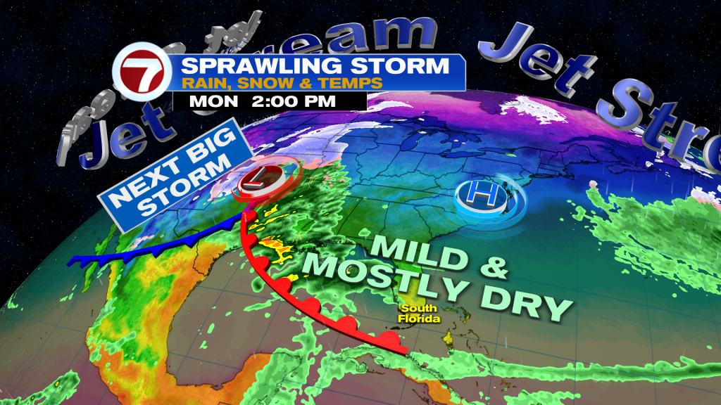
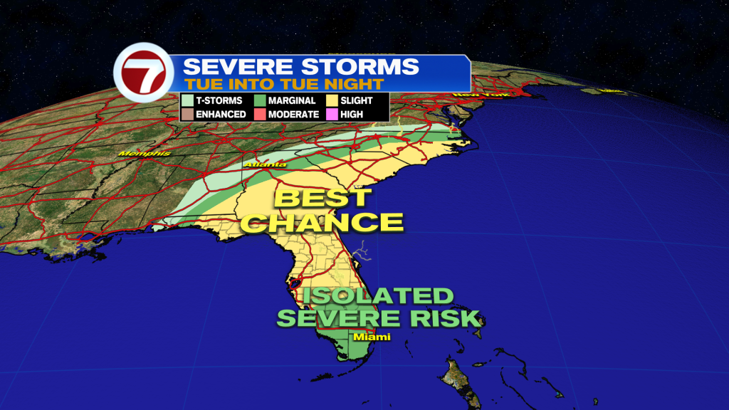
This next system will really influence our weather Tuesday into Wednesday, leading to warm and windy weather Tuesday with an isolated shower, a line of rain and thunderstorms overnight, followed by drying and milder temps on Wednesday.
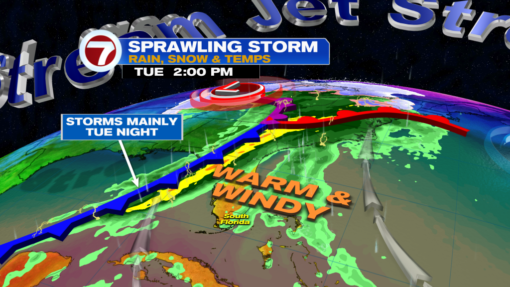
As that front crosses through with this line of storms, there will be the potential again for isolated severe weather, including damaging winds and a tornado.
Enjoy the briefly mild temperatures Wednesday into Thursday because highs should return to the 80s on Friday and Saturday as the next system develops. That could lead to some showers and storms, especially Thursday and Saturday.


:no_upscale()/cdn.vox-cdn.com/uploads/chorus_image/image/72460887/usa_today_18904757.0.jpg)